 |
| Ojibwe families at HBC Sub Post (1884) CP Archives and Ian Macdonald |
Based on ongoing research, Mike McMullen and Ian Macdonald have prepared a series of three articles relating to early Chapleau history. Here is the first: 'Michipicoten Ojibwe: A Permanent Home at Chapleau'. I extend my sincere thanks to Mike and Ian for having these articles ready for while I am in Orlando on one of my periodic visits. My email is mj.morris@live.ca
By Mike McMullen and Ian Macdonald
In a letter dated September 1, 1903, William L. Nichols, Indian Agent located in Sault Ste. Marie, wrote to the Department of Indian Affairs in Ottawa outlining a request on behalf of 16 adult male members of the Ojibwe group living at or near the village of Chapleau. They desired that a small portion of land be acquired for them in this area as this was where they obtained most of their livelihood. The sixteen, representing a total of 52 family members, wanted to establish permanent homes for their families and cultivate small plots of land. Furthermore, they were prepared to pay for this land out of their Robinson-Superior Treaty annuities.
The names of the 16 Ojibwe who made this request for land, with the total family units in brackets, were:
Chessewahninie, Simon Sr. (1+1=2)
Quemzause (1+3=4)
Manawassin, John (1+1=2)
Penewajisik (1+2=3)
Kebekmaise, Peter (1+5=6)
Manawassin (1+1=2)
Chessewahninie, Simon Jr. (1+2=3)
Ashtijizik (1+2=3)
Caudissa, Jacob (1+2=3)
Maymayguess, Moses (1+2=3)
Johnston, John (1+4=5)
Maymayguess, Joseph (1+2=3)
Caudissa, Joseph (1+1=2)
Maymayguess, Ignatious (1+3=4)
Manawassin, Peter (1+2=3)
Okeemahbinasie or Grosse Jambetta (1+3=4)
The 52 persons represented on this list were on the Michipicoten pay list of the Robinson-Superior Treaty. The annuity at this time was $4.00 per person per year.
These Ojibwe were part of the Michipicoten Ojibwe Band (also referred to as Robinson Treaty Indians) located near Michipicoten Harbour on eastern Lake Superior, but were a separate inland group or branch of the band. They tended to camp in the interior near Chapleau, where they hunted, fished and trapped on both sides of the nearby height of land. They would travel back to the Michipicoten River area to trade furs at the Hudson’s Bay Company (HBC) Michipicoten post. Another inland branch of the Michipicoten Ojibwe Band was located near the village of Missanabie (Missinaibi).
In the fall of 1884, a Canadian Pacific Railway (CPR) survey crew came to a site on the east side of the Nebskwashi River where a three-building HBC sub post was being built. The southeast boundary marker of the town site for the future village of Chapleau would be located nearby. One of the photographs taken that day shows a group of indigenous people with their teepees (Photo 1). We believe that they were members of the Michipicoten Ojibwe inland group that some 19 years later would make representations in September 1903 with Indian Agent Nichols for a parcel of land at Chapleau.
With the completion of this HBC Chapleau sub post in late 1884, we believe that the Michipicoten Ojibwe group began to stay in the Chapleau area for most of the year. Carrying out their traditional activities, they were able to trade their furs with HBC at Chapleau without having to go specifically to Michipicoten. There were increasing opportunities for work in the local regional Chapleau economy. These included working in the bush doing such activities as guiding, tree cutting and survey line cutting. At Chapleau, there would have been general labourer activities associated with the CPR and the growing village. Also, by early 1887, there were merchants now located in Chapleau providing competition to HBC for their furs. Perhaps, these Michipicoten Ojibwe realized that their future now depended upon living in the Chapleau area and this required a permanent settlement on land of their own.
The Nichols letter of September 1903 clearly received a favourable response as correspondence showed that the decision to begin the process for granting this Ojibwe request was made within a month of receiving it. Then in October, Indian Affairs informed the Ontario Department of Crown Lands of its intention to purchase land at Chapleau on behalf of the Michipicoten Ojibwe group. Ontario Crown Lands was agreeable subject to an evaluation of any lands in question and a survey.
Perhaps, as a requirement of the process, Nichols, in July 1904, prepared a more formal petition addressed to the Dominion of Canada on behalf of the Michipicoten Ojibwe group. A hand-written document, dated July 20, 1904, with 16 names and witnessed signatures (they signed with Xs), outlined their reasons for wanting land at Chapleau. The group identified themselves as members of the Michipicoten Band, and had just met in Council at Chapleau under local chief Chessewahninie (Simon Sr.) for the purposes of this petition. They requested that land be “set apart for own use and the use of our families while we are absent on voyaging trips or in other work so that we could build small buildings which we could use from year to year.” They wanted it situated near Chapleau so “our children and wives could attend school & church.” In follow-up correspondence, Nichols indicated that the group was currently camping on CPR lands and was concerned about being ordered off at any time. It is evident that Nichols was sympathetic to their situation and wanted a land transaction completed for them as soon as possible.
Shortly after submitting the petition, Nichols suggested land on the east side of the Nebskwashi River, southeast of Chapleau, which he estimated at about 160 acres. He wrote that on this property “the Hudson Bay had a temporary post, but it has all gone to decay” (the sub post constructed in late 1884). Indian Affairs accepted his selection of land for the Michipicoten Ojibwe group. A review and evaluation by Ontario Crown Lands in October determined that this land was not subject to any prior claims, was of little value and the timber was only of use for firewood. Shortly thereafter, arrangements were then made for a survey of the property, which was completed in November 1904 with the official survey submitted in early 1905. The size of the surveyed property was 220 acres.
The land transaction was completed in 1905. In May, Indian Affairs purchased the 220 acre property ($1.00/acre) from Ontario Crown Lands in trust for the Michipicoten Ojibwe group at Chapleau. An Ontario Order-In-Council, dated October 18, 1905, confirmed the transaction. The property was transferred to the Michipicoten Ojibwe Band and designated as Indian Reserve (I.R.) 61.
The purchase of this reserve by the band was paid out of its general funds and reimbursed over time by the Michipicoten Ojibwe group at Chapleau out of their Robinson Treaty annuities
This Michipicoten Ojibwe group now had their land and the opportunity to build their own settlement close to the village of Chapleau. We believe that they would have quickly made efforts to salvage and restore the three HBC buildings on their property before constructing additional structures to house their members. They apparently made noticeable progress in a short period of time. The Treaty 9 Commissioners, who were in Chapleau in July 1906, wrote at that time that the land purchased by the Robinson Treaty Indians (I.R. 61) “has already been substantially improved.” Over time this settlement became commonly known in the area as the Memegos (Maymayguess) site.
In 1906, a picture was taken of Chief Chessequinn (Chessewahninie) being painted by portrait artist Edmund Morris. Morris was accompanying the Treaty Commissioners negotiating Treaty 9. The location would have been at the Memegos site with the Nebskwashi River in the near background and the CPR line in the far background along the far shore.
 |
| The Painting of Chief Cheesequin (1906) Library and Archives Canada |
A 1924 photograph of the site, taken from across the River on the CPR line, shows about 7-8 buildings and maybe there were more. At some point in time, there were two small churches at this site: one Anglican and one Roman Catholic.
 |
| Memegos Site on I.R. 61 on east bank of Nebskwashi River (1924) Vince Crichton collection |
However, by late 1965, only 14 Ojibwe lived on the site with 13 of them being Memegos family members. About 1970, the site was abandoned as a new settlement south of Chapleau, off Highway 129 on I.R. 74A, was established.
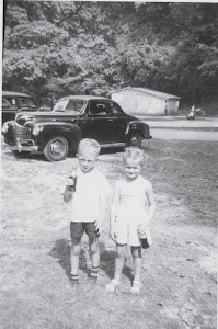
 |
| On the Memegos Site on east bank of Nebskwashi River (2014) Mike McMullen |
We visited the Memegos site in May 2013 and partial remains of three buildings were the only reminder of the first permanent site of the Michipicoten Ojibwe at Chapleau.


No comments:
Post a Comment